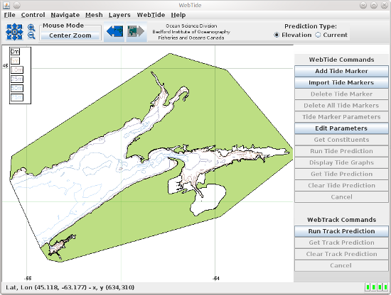
WebTide Upper Fundy Data (v0.7)

Source:
- Bedford Institute of Oceanography
Notes:
- **IMPORTANT** This data is from an inundation model, which includes wetting and drying areas. The tidal analysis calculations in and near the drying areas are compromised and the results from WebTide for those areas should not be trusted. A 0m contour line is drawn to show the areas affected. The analyses from areas shallower than this contour will be most distorted. Areas slightly deeper and near this contour will be affected to a lesser extent and this might not be obvious.
- Ten constituents available: M2, K1, K2, N2, S2, O1, L2, M4, NU2, 2N2
Reference for model / data description:
- Dupont, Frédéric, Charles G. Hannah and David Greenberg. 2005. Modelling the Sea Level in the Upper Bay of Fundy. Atmos.-Ocean. 43(1), 33-47 (2.8MB PDF format)
Windows Data Instructions:
- After downloading, double-click
WebTide_upper_fundy_data_0_7.exe
Notes:
- Be sure to install this data in the same directory that you installed WebTide in.
- If you do not already have WebTide be sure to download and install it before trying to install the data.
Linux / Unix Data Instructions:
- For the installer, open a shell and cd to the directory where you
downloaded the installer. At the prompt type
sh WebTide_upper_fundy_data_0_7.sh
Notes:
- If you do not already have WebTide be sure to download and install it before trying to install the data.
- You might need root privileges to install the data, depending on your system.
- Date modified:

